


The Upper Upper Grand
Written by Wendi Blewett, DLNHC Museum Collections Manager
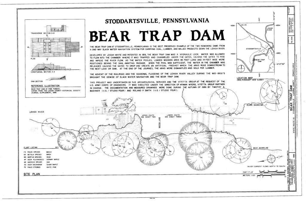
The Lehigh Navigation was originally built to cover 84 miles, from Easton to the Great Falls near Stoddartsville. The descending-only route was made possible by a series of slackwater pools behind bear trap dams, but when the navigation was converted to a two-way route it only extended from Easton to White Haven, about 72 miles of waterway. What happened with the northernmost section?
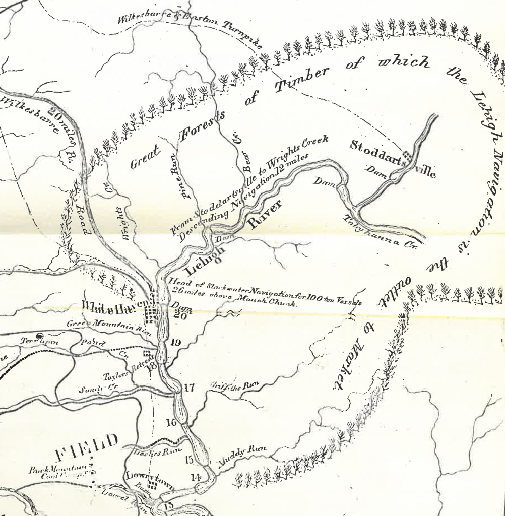
This section, from Wright’s Creek to Stoddartsville, was about 12 miles long and cut through the northern end of the Lehigh Gorge. The area was almost completely wild. In April 1818, less than one month after receiving authorization to improve navigation on the Lehigh River south of Stoddartsville, Josiah White and Erskine Hazard surveyed the entire route and noted the desolation of the area from Stoddartsville to Lehighton. The only ‘well-inhabited’ place along that stretch was Lausanne, a village near the confluence of Nesquehoning Creek and the Lehigh River, and between Lausanne and Stoddartsville there was no sign of human habitation. In fact, White and Hazard were forced to sleep in the forest for six nights while surveying because the area was complete wilderness. According to Henry’s History of the Lehigh Valley, “above the gap in the Blue Mountain there were but thirteen houses, including the towns of Lausanne and Lehighton, within sight from the river.” Stoddartsville itself was just a small community developed in 1815 in anticipation of future improvements of navigation on the Lehigh River. 
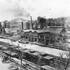
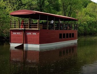
The one-way navigation from Mauch Chunk (Jim Thorpe) to Easton was constructed between 1818 and 1822. Isaac Chapman’s 1826 maps of the Lehigh Navigation illustrated 13 bear trap dams from “Hatchel-tooth Dam” north of Mauch Chunk to Easton and there were multiple channels and wing walls scattered along the entire path. The nature of a one-way navigation meant that the area north of Mauch Chunk was essential as it provided access to lumber needed to build arks, temporary boats used for river transportation. Lumber was floated down from above Mauch Chunk and constructed into shallow wooden boxes about 16 feet wide and 20 feet long. As many as eight to ten of these boxes were hinged together into arks and sent down the Lehigh Navigation all the way to Easton and onto the Delaware River. Upon reaching Philadelphia, the arks were broken apart and the lumber sold. Because the arks couldn’t be transported back upstream, new arks were constantly being built along the Lehigh Navigation’s northern section. This translated into wasted time, money, and labor for White and Hazard. They looked to improve the navigation by building locks that would allow for two-way navigation.
White and Hazard started to rebuild the navigation using lift locks in 1827, completing the two-way navigation between Easton and Mauch Chunk in 1829. On Dec 5, 1835, the Executive Committee of the Lehigh Coal & Navigation Company examined a proposal for a descending navigation between the foot of the Great Falls in Stoddartsville and Wright’s Creek. Surveys of that shallow and narrow stretch of the Lehigh River determined that two bear trap dams would be necessary to overcome the fall of the river below Stoddartsville, the first located just below the Great Falls and the second about 2 ½ miles downstream. A third was needed 9.3 miles below that, in an area called Pine Forest. At the same time, the two-way navigation was being constructed from Mauch Chunk to White Haven. This section, from Mauch Chunk to Stoddartsville, was called the Upper Grand.
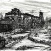
The Upper Grand was destroyed by the flood of 1862, as heavy rains carried tons of lumber and other wreckage down the Lehigh, demolishing dams, locks, houses, and anything else it encountered. The remains of the deep lift locks of the Upper Grand are still visible in many places along the D&L Trail, including north of the White Haven Trailhead. Very few remnants of bear trap dams remain on the Lehigh. What remains of the bear trap dam below Stoddartsville is considered the best-preserved example of the original structures.
Brzyski, A. J. The Lehigh Canal. NYU, 1957.
Gilbert, Joan. Gateway to the Coalfields. Canal History and Technology Press, 2005.
Henry, M. S. History of the Lehigh Valley. Dixler & Corwin, 1860.
“Stoddartsville History.” 2025, https://stoddartsville.com/about-historic-stoddartsville-pa-poconos-lodging/
Tanner, Henry Schenck. A Description of the Canals and Rail Roads of the United States. T.R. Tanner & J. Disturnell, 1840.

Join the Conversation!